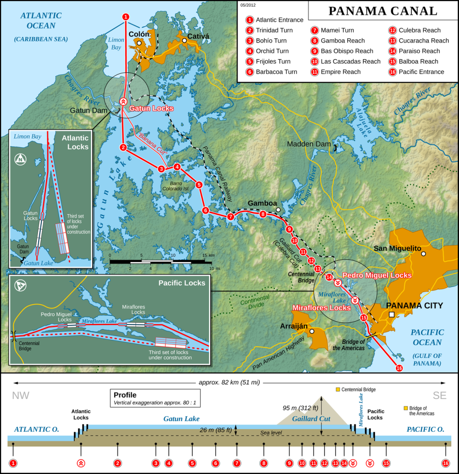
The Panama Canal moves ships between the Atlantic Ocean on the east side and the Pacific Ocean on the west side. However, the Canal runs northwest to southeast. To avoid confusion the directions southbound and northbound are used, which is the terminology employed by the ACP.
The Canal consists of seventeen artificial lakes, several improved and artificial channels, and three sets of locks. An additional artificial lake, Lake Alajuela (known during the American era as Lake Madden), acts as a reservoir for the Canal.
A précis of your southbound passage from the Atlantic to the Pacific (a total 44.3 nautical miles) is:
- A breakwater protecting the large natural harbour of Limón Bay (Bahía Limón) marks the start
- 8.7 km (5.4 mi) past the Cristóbal deepwater port and the Colón Free Trade Zone (a free port)
- A 3.2 km (2.0 mi) channel forms the approach to the Gatun locks
- 1.9 km (1.2 mi) through the Gatun Locks, three steps to lift ships about 26.5 m (87 ft) above sea level
- 24.2 km (15 mi) across Gatun Lake, an artificial lake formed by the building of the Gatun Dam,
- 8.5 km (5.3 mi) along the Chagres River
- 12.6 km (7.8 mi) through the Culebra Cut, passing under the Centennial Bridge
- 1.4 km (0.87 mi) through Pedro Miguel Lock, one step down 9.5 m (31 ft)
- 1.7 km (1.1 mi) across the artificial Miraflores Lake at 16.5 m (54 ft) above sea level
- 1.7 km (1.1 mi) through Miraflores Locks, two steps down 16.5 m (54 ft) at mid-tide
- 13.2 km (8.2 mi) across Balboa harbour, in sight of Panama City, passing under the Bridge of the Americas
The Atlantic entrance to the Canal is 22.5 miles west of the Pacific entrance.
A ship traveling from New York to San Francisco saves 7,872 miles by going through the Canal instead of around the tip of South America.
The Panama Canal area is not the narrowest section of the country. Further east the Carti-Bayano area is only 28 miles coast to coast.
How Does the Panama Canal Work?

The Panama Canal connects the Atlantic Ocean (Cristobal on the Caribbean Sea) and the Pacific Ocean (Balboa).
The Pacific Ocean is at a different level to the Atlantic, and the Atlantic has tides of less than three feet while the Pacific varies around 20 feet. This is why a sea-level Canal would not be possible.
All of the chambers have a lift of around 29 feet, except for the last Miraflores Lock which must compensate for the Pacific tides.
Water is moved from a higher lock chamber to a lower one using only the force of gravity.
Approximately 26 million gallons of Lake Gatun water ends up in the ocean each time a ship passes through one end of the Canal, making a total of 52 million gallons for a complete transit.
These steps describe ascending the Gatun Locks.
(1) Enter First Lock Chamber
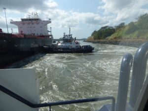
Your ship will approach the first part of the locks and go alongside the longer centre wall. You will probably see two tugs helping to push the ship sideways against the wall.
Once in this position the first mule wires are attached on the shore side. The ship will then move forward to pick up the mule wires on the other side.
Look for the rowboat that is used to pass the lighter heaving lines across so the ship’s crew can winch the heavier wire onboard.
Once the mules are secured on both sides, the ship will move forward into the first chamber. This is done under its own power, with the mules keeping the ship centred in the lock chamber(s).
(2) First Chamber Fills
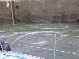
A valve is opened and water flows by force of gravity from the higher chamber to the lower one, equalising the water levels, and raising the ship up around 29 feet above sea level.
You won’t see much of your own chamber from the ship, but you might be able to watch the water ‘boiling’ in the adjacent chamber.
(3) Move to Next Chamber
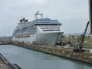
Once the filling is complete, the gate in front of the ship will open and the ship will move forward into the second chamber, once again under its own power with the mules keeping it centred.
(4) Second Chamber Fills
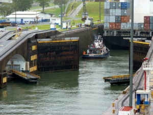
The gates will close behind the ship. Here you can see a road bridge extending across at the same time.
The valve of the next highest chamber is opened, and water flows into the second chamber, raising the ship again.
(5) Move to Third Chamber
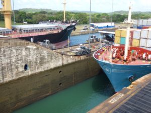
The same process happens again, this time with water spilling from Lake Gatun into the highest chamber, so the ship ends up at the height of Lake Gatun.
26 million gallons of water will have been taken from the lake. This is replaced by rainfall.
This picture is the rather unusual sight of two ships transiting in opposite directions.
(6) Chamber Fills and Move to Gatun Lake
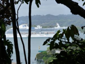
Once the water level is equal, the gates will open and the ship exits the locks and enters Lake Gatun at around 87 feet above sea level.
The original height of Lake Gatun was 85 feet but this does vary according to rainfall. Part of the expansion project was to raise the maximum height of the lake to 87 feet.
